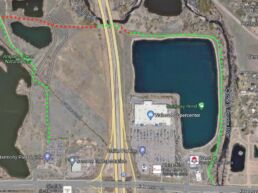
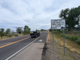
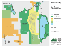
 Bird’s eye view of the Fossil Creek Trail Extension. Over the 12 months, many new multi use paths (MUPs) will be coming online, connecting huge sections of Northern Colorado Trail Systems. The cities of Fort Collins and Loveland have been working with Larimer county on two paths that will connect over 50 miles of trails between the two cities, those are in addition to a long awaited trail in Southwest Fort Collins.
Colorado Front Range Trail (2 mile section from Fort Collins to Loveland)
Updated 08/30/2017
The first ever trail connecting Fort Collins and Loveland is slated to be finished in September 1st at the end of Sept of this year. According to the Coloradoan, the 2 mile paved path will connect Loveland’s Recreation Trail — just west of Boyd Lake State Park — to Fort Collins’ Fossil Creek Trail at Carpenter Road between Lemay Avenue and Timberline Road. The new connection will tie 18 miles of trail in Loveland to 35 miles of trails in Fort Collins.
Map: http://www.co.larimer.co.us/openlands/cfrt-project-site-map.pdf
The Colorado Front Range Trail is a partnership between Larimer County, the Cites of Fort Collins and Loveland, Great Outdoors Colorado and the Colorado Department of Transportation.
Long View Corridor Trail
The second trail connecting the two cities. the Longview Trail Corridor will run from Fromme Prairie, South to 57th Street in Loveland. The 4.4 mile long concrete path will run through five existing opens spaces and natural ares. The final design of the project has been completed and construction should start this summer with a May of 2018 completion date.
Map: http://www.co.larimer.co.us/openlands/long-view-corridor-map.pdf
Fossil Creek Trail Connection: College Ave. to Shields St
The much anticipated Fossil Creek Trail Connection appears to be with in a year of completion. A tunnel under the BNSF railroad had delayed this trail for years. Once completed, this trail will connect the Spring Creek, Fossil Creek, Mason Street and the Power Trails thus enabling riding throughout Fort Collins and to Loveland, all without riding on the road.
The tunnel under the railroad tracks has been completed. The city is currently finalizing the plans for the path to connect to the Mason Street Trail to the East and through the Applewood and Clarendon Hills neighborhoods to the West towards Shields Street. Construction on the actual path is scheduled to begin this fall with a late spring/early summer completion date.
Map: http://www.fcgov.com/parkplanning/pdf/fossil-creek-project-map.pdf?1466028838
Poudre Trail to Poudre River Trail Corridor
Via the Larimer County Website:
Once complete, the Poudre River Trail will be over 40 miles in length, from Bellvue, north of Fort Collins, to Island Grove Park in Greeley. The trail is currently in three sections separated by two gaps. An approximately 15-mile section is located in and managed by Fort Collins, a 1-mile section is in Timnath and a 21-mile section is located in unincorporated Larimer County, Windsor, Weld County and Greeley. The Poudre River Trail at River Bluffs Open Space connects to 21 beautiful miles of trail running southeast through wildlife areas and parks. Both Fort Collins and the Poudre River Trail Corridor, Inc., a non-profit organization, currently manage sections of the trail.
Although the trail is inching closer and closer to completion, land easements and the I25 expansion continue to delay what will eventually be beautiful 40 mile trail. The I25 expansion which will include a trail underpass will hopefully be completed in 2018. Further land acquisitions for the final few miles will hopefully be completed shortly there after.
