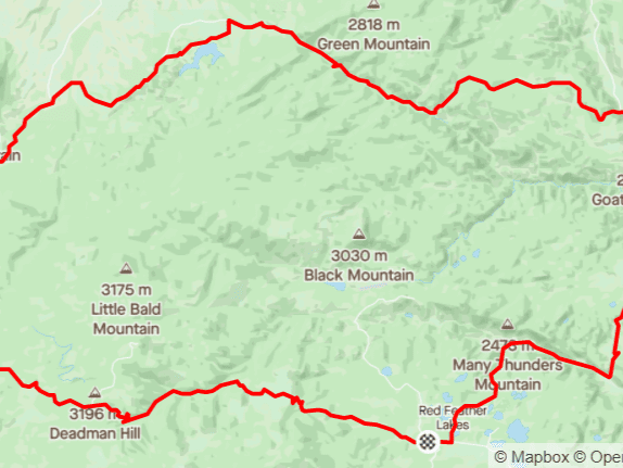
Distance: 22 mi.
Elevation Gain: 1250 ft.
Climb Rate: 590ft per 10 miles.
Percent of Gravel/Dirt: 93%.
Ride Time at 15mph: 1 hr 10 min.
Strava Info and GPX
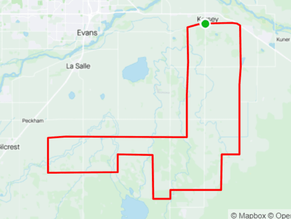
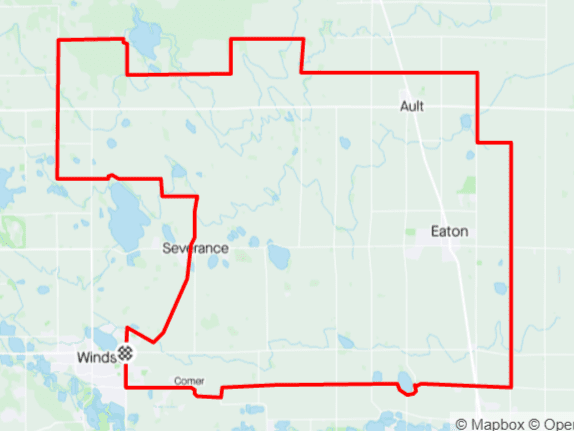
This is another starter loop shows you some of the terrain of Weld County. Right at the start, and again towards the end, the two miles on Weld County Road (WCR) 86 are a bit steep and on dirt (rather than gravel) roads, but you get rewarded by riding past a bison herd as you approach WCR 19. Do the loop counter-clockwise and enjoy the slightly twisting roads going north on WCR 25 and turning onto WCR 88 — a rarity in Weld County, as most of the roads there are straight and either east-west or north south. As you come back south on WCR 19, pay attention to the trees along the north shore of Black Hollow Reservoir: Eagles often nest there.Take the time to learn the numbering system of roads in Weld County: even numbers are east-west, odd numbers are north-south. Parallel roads are always one mile and two numbers apart. If you remember that Mulberry Road is WCR 82 and that the interstate would be WCR 7 if it were in Weld County, you will always know where you are and how far it is to get home. For example, the NW corner of this route at WCR 29 and WCR 90 is 22 numbers (=11 miles) east of the interstate and 10 numbers (=5 miles) north of Mulberry, so it would take you 16 miles to get back to Mulberry and I-25 if that’s where you had started.

Route provided by Wolfgang Bangerth