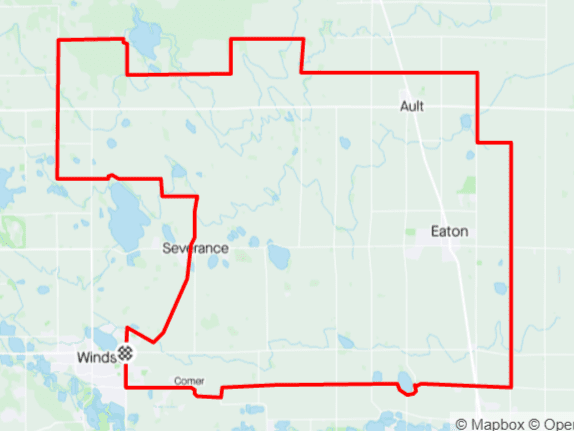
Distance: 65 mi.
Elevation Gain: 2550 ft.
Climb Rate: 390ft per 10 miles.
Percent of Gravel/Dirt: 66%.
Ride Time at 15mph: 3 hr 35 min.
Strava Info and GPX

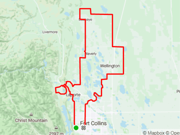
The only place to get water is if you detour to Wellington, but there are 40 miles without services.For roadies, the world north of town ends at Buckeye Road that runs by the power plant. But for gravel riders, Larimer County Road 5 goes a few miles further north. If you ride this route clockwise, LCR5 provides great views towards Soapstone Prairie. After crossing over the interstate, you get a few miles of paved road before heading back south. I love the stretch on WCR 120 through some cliffs, and then the whole stretch going south because of the views of the mountains. Taking WCR 17 from Nunn Road (WCR 100) to WCR 96 provides a bit of extra spice.
Route Provided by Wolfgang Bangerth