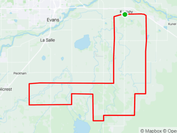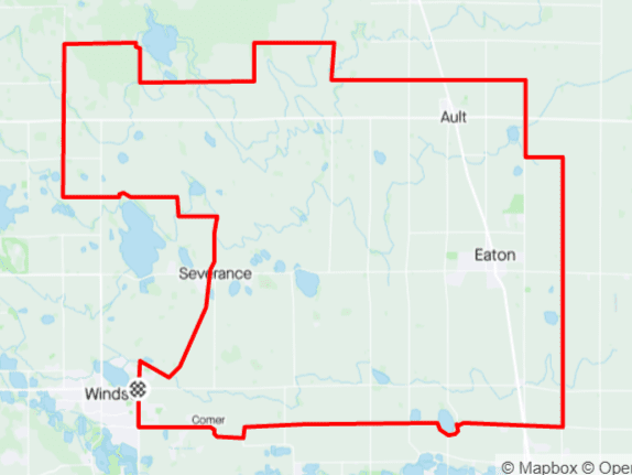
Distance: 69 mi.
Elevation Gain: 2200 ft.
Climb Rate: 320ft per 10 miles.
Percent of Gravel/Dirt: 69%.
Ride Time at 15mph: 3 hr 45 min.
Strava Info and GPX
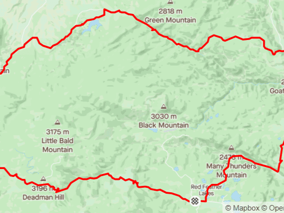
You might be out of cell phone range for many miles, and you might not see a car for a couple of hours — so plan accordingly. You can get water in Nunn on the way out, and detour to Pierce or Ault on the way back, but that still leaves 40 dry miles in between.This is the route you need for severe cases of the blues, or if your significant other is out of town and you don’t know what to do. It’s a little bit of a haul to get out to Nunn, but going further east of Nunn takes you into areas that are not much used agriculturally and where you can stand on hills, watch over an area of 100 sq mi of prairie, and see three or four houses. Between late August and early April, your view will also have only two colors: Blue for the sky, and gray/brown for the prairie and the road. As you ride back on WCR 86, scan the horizon: On clear days, you can probably see half a dozen of Colorado’s 14ers (Longs Peak, Grays and Torreys, Evans and Bierstadt, Pikes Peak) and the entirety of the Indian Peaks Wilderness. The lack of traffic on these roads gives you time and space to think.
")
Route provided by Wolfgang Bangerth