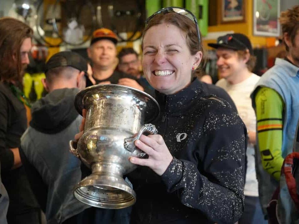
It’s a bit delayed, but here’s Zack Allison’s North South Colorado race report. After scratching in 2023, Zack won the 600 mile 2024 version with an unofficial time of 3 days 5 hours 12 minutes.
North South Colorado – A Long, Solo Win
By Zack Allison
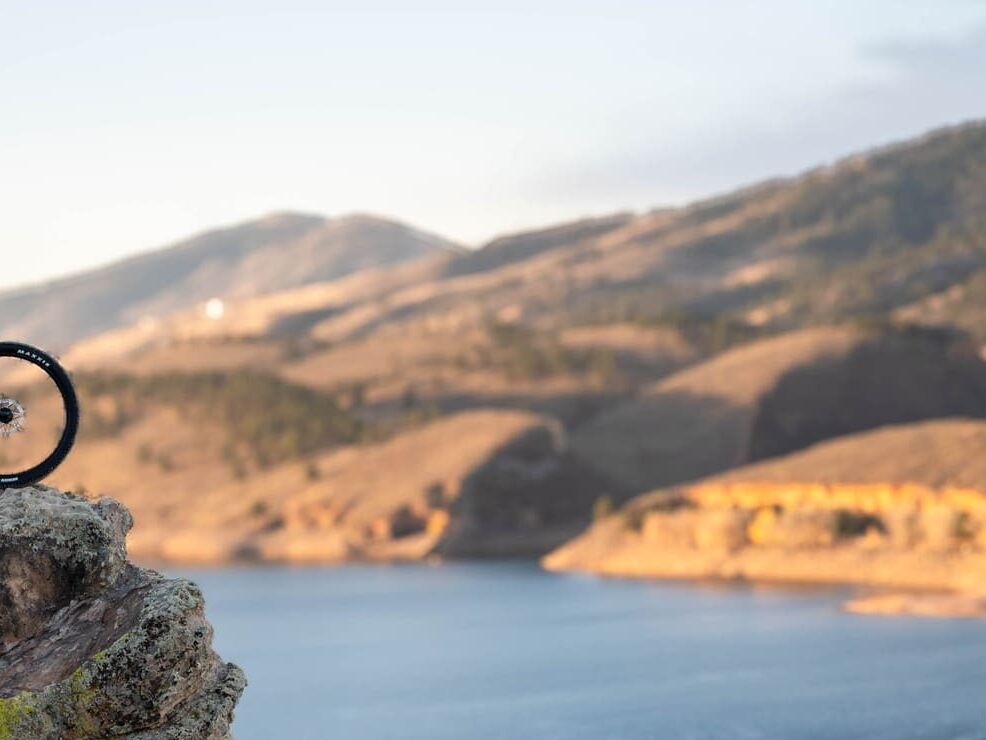
North South Colorado – a bike packing race from Fort Collins to Trinidad, Colorado, the hard way. The race started on July 5th at 6am in Fort Collins with around 60 racers on the line to attempt this diabolical route of 610 miles, 50k feet of climbing, across Colorado’s Rocky Mountains, majority gravel, some trail, and dirt roads.
A ragtag band of bikepacking crazies rolled out on the Poudre River Trail for a chill start. Early morning mumbles turned into semi-nervous conversations. It could have just been me who was nervous, but there’s something about mile 2 of a 610-mile route that feels a touch daunting. Poudre River Trail – to Taft Hill Rd – to Livermore Colorado – and straight up into the mountains.
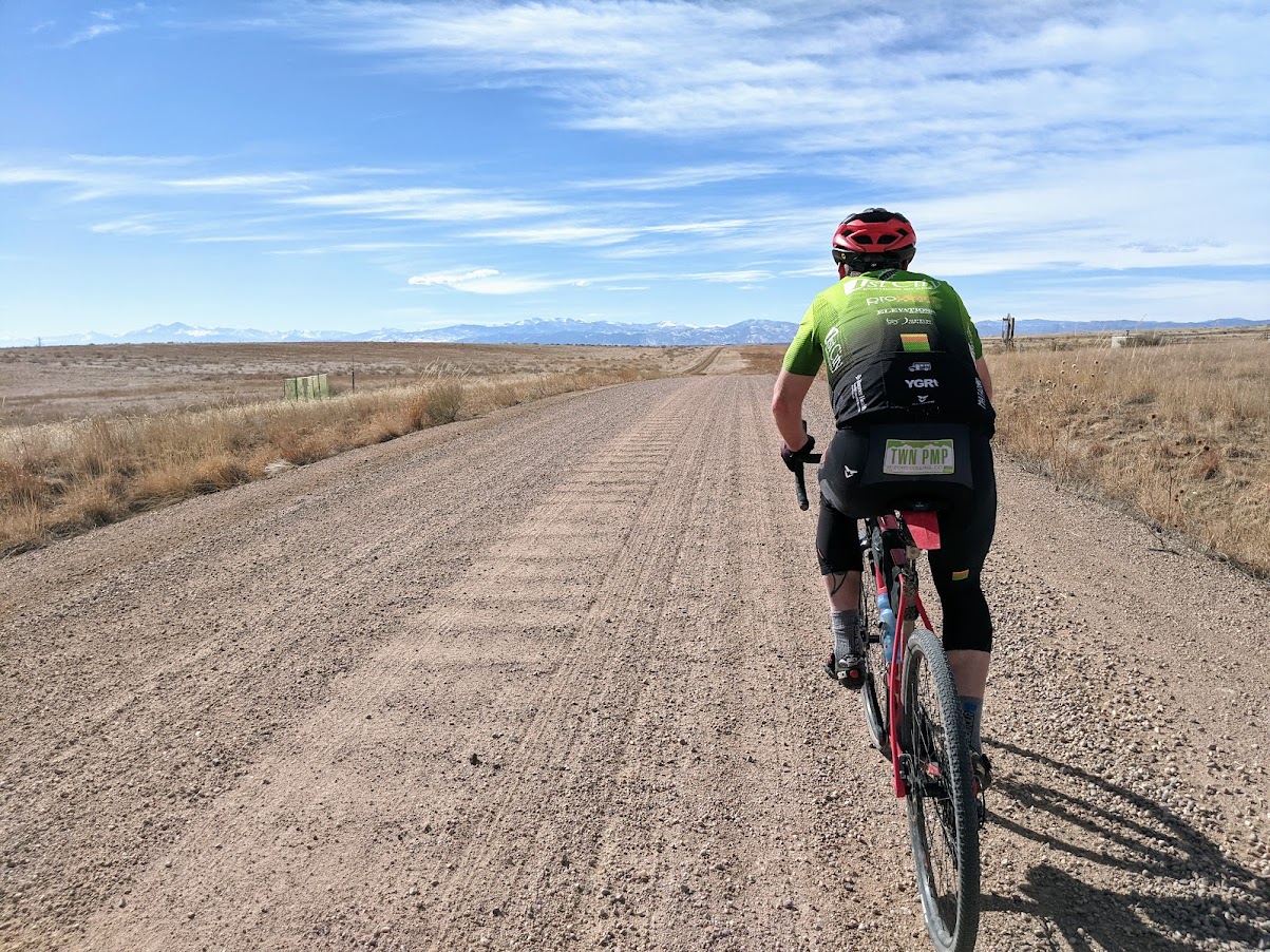
The race split up early, and naturally, as the rollers got bigger and bigger. By the end of Taft Hill Road I’d find myself off the front, alone, and in the lead for the remainder of the ride. Through the Cherokee Park corridor, we got a high-elevation vantage of the Wyoming border before turning south, destined for Trinidad.
From Cherokee Park you head up Laramie River Road to the Poudre Canyon, AKA: Hwy 14, AKA: Cameron Pass. I got some tunes going, probably 30 total hours of listening to “Willin’” by Little Feat and “East Bound and Down” by Jerry Reed, in between raw dogging most of the ride staring at my tire on the dirt road in front of me.
Laramie River Road is always mind-bending to me as you’re climbing up, next to the Laramie River, which is going the other direction to the Poudre River which flows east being on this side of the Continental Divide. I get how gravity works and all, but it always seems odd to me to climb up to a bigger river canyon next to a river flowing north.
With a 2L camelbak and a 1L bottle on the frame, I’d planned on bringing enough food and water to get to the store in Gould just over Cameron Pass, but I ran out of water towards the top. So I snatched some fresh, super clear water out of Michigan Ditch to tie me over until the Gould Store. I was delighted that it was less windy than the normal gail force at the top of Cameron Pass – making for a quick pop-down.
The gentleman running the Gould store was curious how many people there’d be from the event (like maybe he’d run out of snacks or something?) and wanted to make sure my cleats weren’t digging into his floors. After seeing that my money was as green as anyone else’s, he was happy to take it for 2 Gatorades, a gallon of water, a coffee drink, and 2 microwave chimichangas. From Gould, we entered the Routt National Forest and 20 miles of steep, rolling, chunky terrain to traverse. This was the first place I felt the 45mm WTB Vulpines were maybe a bit aggressive, but I suffered no flats or mechanical issues. I made my way pretty quickly to Hwy 125 – a paved climb – up to Willow Creek Pass at 9,600 feet before a fast, paved, descent down to Stillwater Pass road.
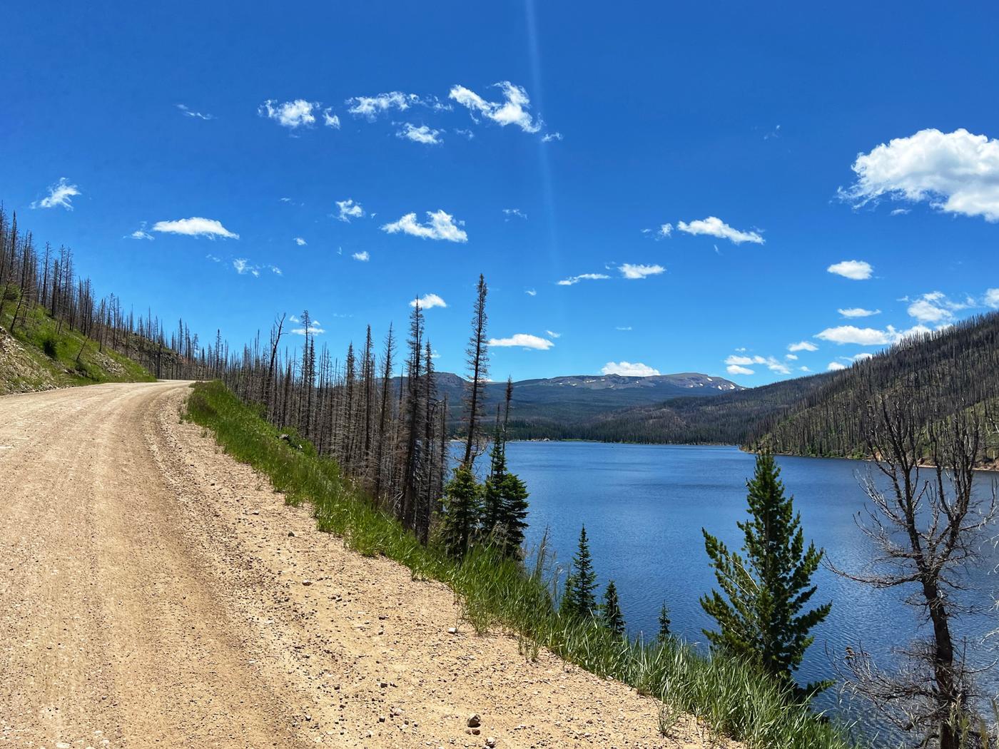
Stillwater Pass has been closed for a bit due to fires and floods but it all looked open. It’s a brute of a climb with the road getting progressively rougher and steeper as you get to 10,500 feet. Over the top, I had some cell service so I checked that my tracker was working. It was not. So I moved it to a different location and made sure it tracked a point. I checked Trackleaders to see where I was at and was pleased at the gap, but noticed the Stuart brothers putting on a solid chase. I just stuck with the plan of sending it over Rollins Pass for the day and getting as close to Idaho Springs as possible before a potential nap.
I stopped in Granby for some pizza, maybe a New Belgium Hard Charged Ice Tea, and all the rehydrations. On a map, it looks like a short gap between Granby and Winter Park but from Granby we headed up the Granby to Winter Park trail connector, which is a rad, albeit challenging, way to get there. I started charging my phone off my Sinewave light and dyno hub as I had to turn my lights on just before Winter Park. This was the start of my inexperience showing.
I suck at battery management. Luckily the Garmin 1040 Solar has unbelievable battery life, after riding all day to this point I had 85% battery still. My phone on the other hand, was pretty low and the Sinewave USB charger is like 3 watts output. I should have put my phone on low power mode from the start, and still, it would take hours and hours to charge. I got all the food I could at the Snack N Save in Winter Park knowing it would also be breakfast the next day and charged my phone for a bit on the outdoor outlet before heading up Rollins.
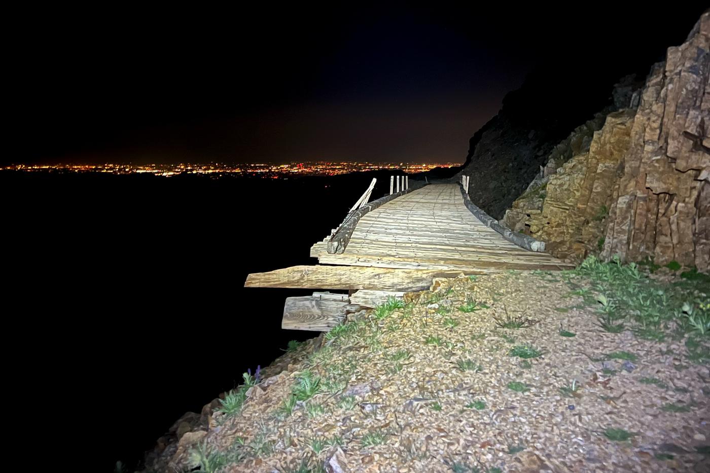
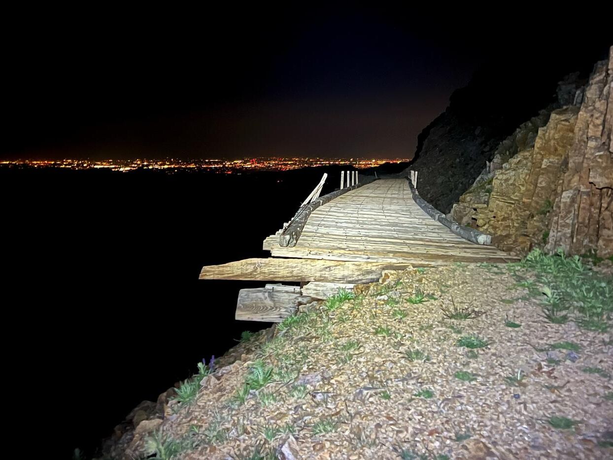
Rollins is a beast. The Winter Park side is a nice grade and not very technical or steep but as I was riding it in the dark, line choice is tricky. I hit the trail and train trestle just before midnight. The descent down to Tolland was a real taint-buster. I made it down and decided to keep pressing on over Mammoth Gulch to get it over with – because I friggin hate Mammoth Gulch, so it’s probably better at night anyway. I probably hiked half of it as it took me an hour to go 4 miles to the top. Still not really tired and I wanted to make it a fair bit lower before trying to sleep, I headed down the trail towards Central City.
This trail down from Mammoth Gulch is chunky. Maybe more chunky than normal, or maybe it was just dark and my headlamp was dead and my Sinewave light is pretty dim at 10 mph. So it was a real chore. You pop out of this section on some rolling dirt roads just above Central City. It was 3:30 am and I was warm enough so I decided to take a nap a couple miles from Central City next to an old cemetery.
Huge shout out to Anton Krupicka and Andre Onermaa, you guys have posted some race reports of North South in the past on Strava. Those reports are great reads but it’s also really cool you guys share that info. I read all those and they closed some gaps in my lack of bike packing experience, and they’re invaluable tips – like camping near this cemetery where nothing will bother you as long as you’re right with the spirits, which I seemed to be.
I slept for about 90 minutes. Woke up pretty cold but that’s bound to happen and got everything packed up in a couple of minutes and onto a couple of kickers through Central City. I warmed up quick, shot down Oh My God Road to Idaho Springs. I hit the Idaho Springs Kum and Go. Changed kit, cleaned up a bit, breakfast burrito, coffee, and sunscreen. I checked Trackleaders and saw that the Stuarts camped just past Winter Park and were moving pretty well up Rollins, but were at least 5-6 hours back. I got moving.
I was feeling pretty motivated by all the new roads in front of me. I started with Little Bear, which was an absolute pleasure of a way to start the day. Kicked it pretty good over the top and then the route descends some really fun switchbacky pavement down to Evergreen. I’ve never really ridden around this part of the state, but it seemed like a busy route for turns and trails between Evergreen and Conifer.
Evergreen to Conifer there was some trail, some steep kickers, and I started to drag a bit. I stopped at the Stinkers in Conifer to refuel. I probably didn’t eat or pick up enough food here as I thought it would be a quick jaunt to Deckers. Just after Conifer there’s 10 miles of the North Fort Trail. The hike up to the top to start was pretty loose and hot, however, the trail itself was really fun, ripping around on some fast, loose segments. The fun turned into fatigue quicker than I’d have liked, but then I was out and onto S Platte River Road for some fast, flat pavement riding to Deckers.
I thought Deckers would have like…..a store or… something substantial. What’s there is a so-called convention center with a strange restaurant, but you can only get chili and/or a couple of iterations of Frito pie… aaand for another $5 you can use the internet. After begging for internet with it being too late to give back the Frito pie I got out of there after spending way too much time just frustrated at the place and not fully prepared for the next sector…..Matuka Road/Goose Creek.
In reading Anton’s previous reports, I knew this was sort of a hard exposed section but it sucked for more reasons than just that. The road was somehow a huge sand trap, brake bumped to the max. Being July 4th weekend, there are hundreds of campers up there with their motorized toys of all sizes. Rolling from steep climb, to slow sand pit descent, from mile 310 to 330. I melted a bit. Was a bit over-electrolyted and under-fueled and I’m doing the math that I’m not making it to Lake George before 5:30 pm when the store closes. So, I’m in a bad spot. I confirmed the Goose Creek Campground water spigot pump does not work, filtered some water from the Goose Creek itself, and just kept moving towards Lake George to figure it out.
A quick road tailwind section later – still cracked – Lake George Store is closed, BUT lucked out that across the street at the fly and tackle shop, there’s a random BBQ food truck that still had food and beverages. Smashed a brisket sandwich thinking it was either going to be great or turn on me on the way to Cripple Creek, but it worked out.
I zoomed out a bit on the Garmin to see what climbs were ahead to Cripple Creek……..that was a mistake. I knew it climbed up to Cripple Creek, but damn. A cat 1 climb, a 2 mile descent, a cat 3 climb, and then you roll into town. It was dark for the climbs, and I was a bit sketched out by the road knowing that most of the freetime in Cripple Creek is spent drinking and gambling, but luckily there was very little traffic.
I rolled into Cripple Creek set on spending the night there. It was pretty cold and there were hospitality opportunities, so I decided to try to find a room. Mainstreet is lined with hotel-casinos, all with signs dangling the allure of 24-hour restaurants. However, every casino’s hotel was 100% booked. Walking through seas of slot machines to find the front desks that would let me know they’re all full. to find out it’s all booked. The patrons and I would lock eyes, each with a unique-11pm-dead-inside stare.
I finally found an open room at The St. Nicholas – 2 blocks and 200ft of climbing off Mainstreet – I was greeted by the super-cool dude who runs the place, and lives there. He gave me a brief tour of this former hospital-now-hotel and showed me to my room. Apparently, this hotel is quite haunted, but it was a cool spot. And I guess I’m right with the spirits. Charged my electronics, charged my Di2 – which was a huge relief to charge 372 miles in, without really knowing how long the Shimano GRX Di2 actually lasts in this situation – and caught a few hours of sleep.
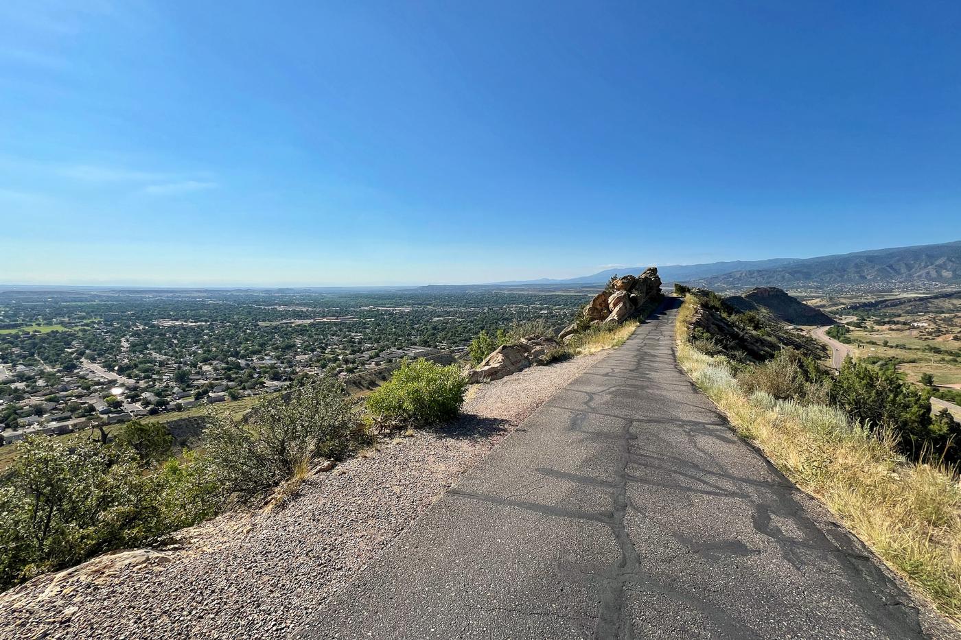
I was pleasantly surprised to not be beginning this day again in freezing temps, despite leaving Cripple Creek pretty early in the morning. Headed off towards Cañon City on Shelf road was amazing. It’s a technical descent with fast roads, bighorn sheep, rock arches outcroppings, and allaround was a really nice way to start the day. After Shelf Road, straight into Red Canyon Park for some rolling climbs on red rock-lined roads before hitting Cañon City’s Skyline drive. All of these sections were pretty rad.
Elevenses (shout-out Shire Folk) in Cañon City then a push to Silver Cliff/Westcliffe. Once again, I checked TrackLeaders. This time to find that the Stuart brothers had scratched, so some race-situation pressure was off, but honestly, it was not a boon to my motivation and thereby my speed. Chris Langager was the next chaser and he looked like he was moving pretty good, but it was a big gap back to him.
Out of Cañon City, Oak Creek Grade was a brute. Arriving in Westcliffe, I hit the first store and had some great homemade chicken sandwiches, and burgers with all the fixings. Ate one, packed one, and got all the fuel I needed knowing there was an 80 mile gap from here to Walsenburg. As I got further south along the Hwy 69 corridor the wind switched and was blowing a big storm towards me. Then off the highway and onto loose, steep rollers with sizable brake bumps. Just sucking the morale down. When I finally got back down to Hwy 69, I was headed into the town of Gardner.
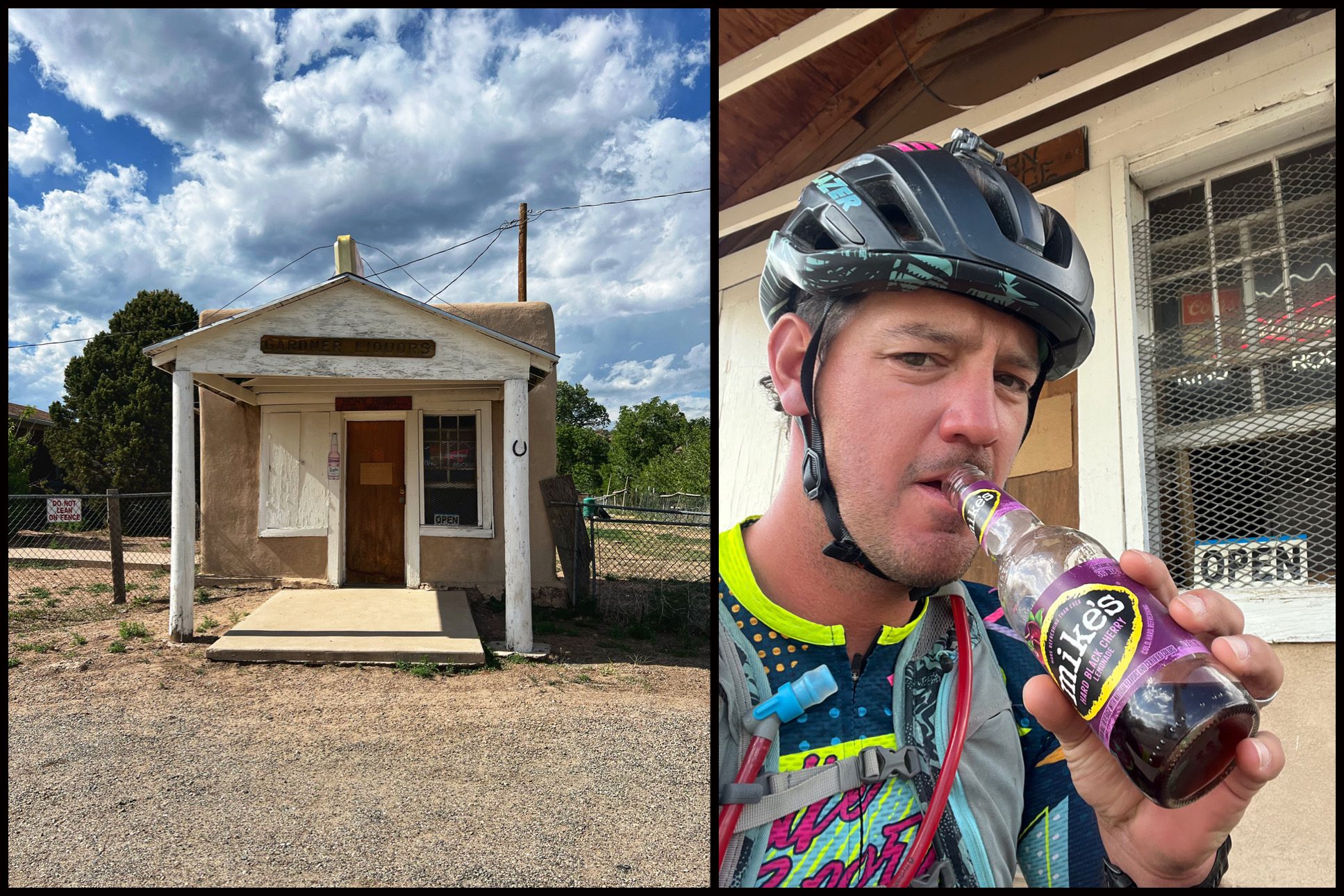
I had looked up Gardner before and knew there was no store or services here, but I did come across “The World’s Smallest Liquor Store” the only store in Gardner with an open sign. I think it’s always open as the guy lives next to it and when the dog barks he knows someone wants some booze. Unfortunately, it was cash only and I only had a dollar bill left. He took pity on me, and we settled on a warm Mikes Hard Lemonade. Basically, I got iced. Not sure if it was the Mike’s or the last 70 miles of warm headwind that caused my nose bleed, but that drove home my indifference to this whole sector from Westcliffe to Walsenburg. I did my best aerobar sprint over the last few miles to Walsenburg as the ominous-looking storm cell finally hit me.
I made it just in time to the TravelCenter in Walsenburg to not get hailed on, but spent way too much time there. A burger, fries, and probably a half gallon of coffee later I was ready to keep rolling. It was 9pm, mile 512 and I’d bought everything I thought I needed to make it to La Veta to camp. Got to La Veta around 10:00, and then decided to keep going a bit further towards Cuchara.
About 10 miles before Cuchara it started to rain. It was a bizare feeling as I still had a ripping tailwind, which was warm, and the rain was moving in the same direction as me at a similar enough speed that it was just in the air all around me and not really getting me wet. That lasted about 30 minutes. I couldn’t stop and camp in the rain, without risking freezing, so I was sort of committed to finding something to sleep under in Couchara. I did a quick lap of the old town to see if there was a porch or storefront to dry off and nap under with no luck. Just behind the Couchara store, there’s an abandoned building with a slanted roof storage bit, that was my best option. It was about 1am, I dried off the best I could, put on the dry clothes I had, and bivvied up. I don’t think I slept at all, but the rain stopped around 4am.
I tried to get a less wet hour of extra sleep but it didn’t matter with how cold and damp I was. So, I figured I may as well get going. I slammed some food and a Red Bull I carried from Walsenburg and rode up to Cuchara pass to warm up. From Cuchara pass you head a bit north and up to Cordova pass at 11.2k feet, just in the shadow of West Spanish Peak. I took my down jacket off for the climb but most of my body never fully warmed up. This is a beautiful area. Still being in a rain cloud, thick healthy forest, fun dirt roads over Cordova Pass, and it was starting to feel like I was in the home straight.
On paper, it’s a long descent to Trinidad but after the initial descent from Cordova Pass it’s sort of death by a thousand cuts. Coming down Burro Canyon towards Trinidad it hit 80 degrees and sunny. Those swings and the layers just make the body freak out a bit. I crawled over the 7 or 8, 1-to-2 mile climbs to Trinidad Lake. Going around the lake on trails with short kickers that really sting the legs but I was jamming along, knowing I was in the last 10 miles.
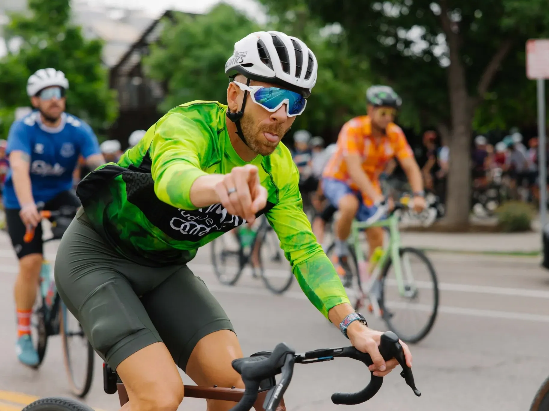
The last smooth dirt road into Trinidad takes you within a couple miles of the finish at Cimino Park. My wife Whitney was waiting for me there to get the most-Cracked-Zack-content anyone’s ever seen.
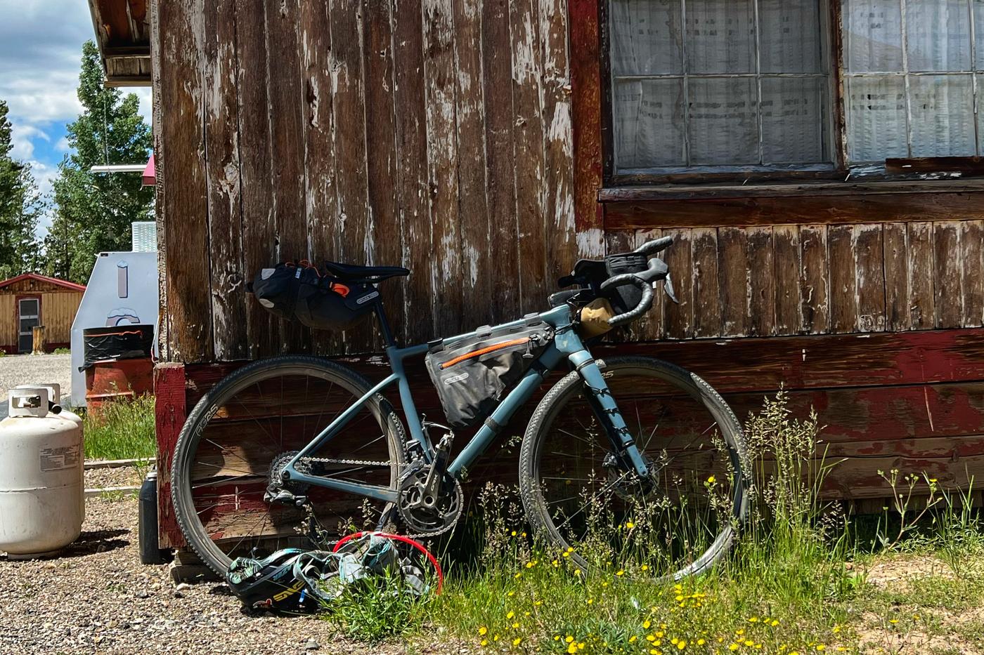
The Rig
- Enve MOG
- Shimano GRX Di2 12 speed 2x 48/31 rings 11/34 cassette
- Enve Gravel Bars 42cm
- Amazon special carbon aero bars
- Enve Seatpost
- Enve AG25 Wheels, i9 rear hub, Sinewave generator front hub and light
- WTB Vulpine 45 S SG2 tires
- Ergon BT Gravel Bar Tape
- Ergon SR Allroad Core Pro Carbon Men Saddle
- Ortlieb Waterproof 11L Seatpack
- Ortlieb Waterproof 6L Frame Pack
- Oveja Negra snack pouch
- Snek burrito bar bag
- Garmin 1040 Solar
- Garmin Inreach mini 2
If you enjoy this content and appreciate the hustle that goes into YGR please consider supporting the site.