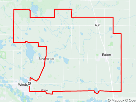
Distance: 34 mi.
Elevation Gain: 1050 ft.
Climb Rate: 310ft per 10 miles.
Percent of Gravel/Dirt: 51%.
Ride Time at 15mph: 1 hr 50 min.
Strava Info and GPX

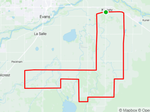
This is the first slightly longer route on this list. The last point where you can get water is around mile 10, so bring enough water bottles for the remaining 25 miles and remember that you will be slower on gravel:This is an intermediate length tour that takes you along the shores of some of the many many reservoirs north of town. Most of this area is irrigated and farmed, but once you go west and cross LCR 19 (the extension of Taft Hill Rd), the land is too high to get water from the canals and remains too dry to farm — so you only see occasional cows on dry pastures. The way back going east on West LCR 66E leads up a lovely hill with great views before finally spitting you out on LCR 15, from which you can take the remaining miles home on a paved road.
Good riders average around 13-15 miles per hour, excluding stops.

Route provided by Wolfgang Bangerth