If all goes according to plan, the Poudre River Trail will connect Bellvue to Greeley, passing through Fort Collins, Timnath, and Windsor by this winter. Three sections of trail totaling about 2 miles need to be completed before we can ride all 40 miles from start to finish. See below for detailed information.
Interactive Map
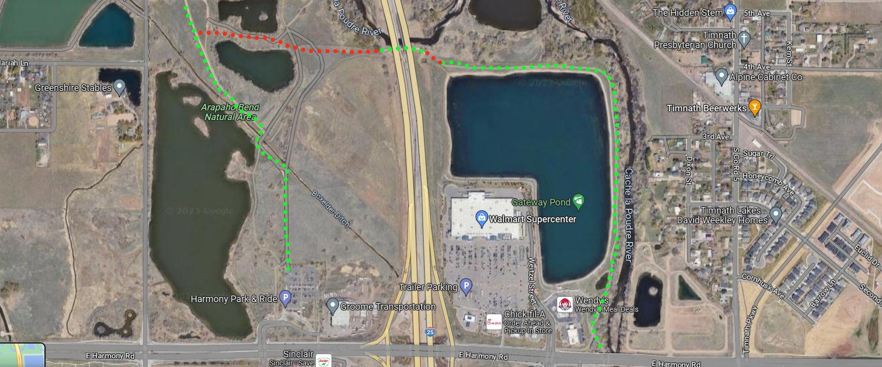
Timnath, Under I25 to Arapahoe Bend
As you know, CDOT recently finished the trail under I25. The city had planned to begin construction on the trail connecting Arpahahoe Bend to the City of Timnath via the I25 underpass earlier this summer, but a dangol’ eagle decided to nest in the area, and delayed construction. Thankfully, the eagles have left the nest and construction is planned to start in August. It should last about two months.
The red dots indicate what needs to be completed. The green dots represent completed trail. This section is about 1/2 mile long.
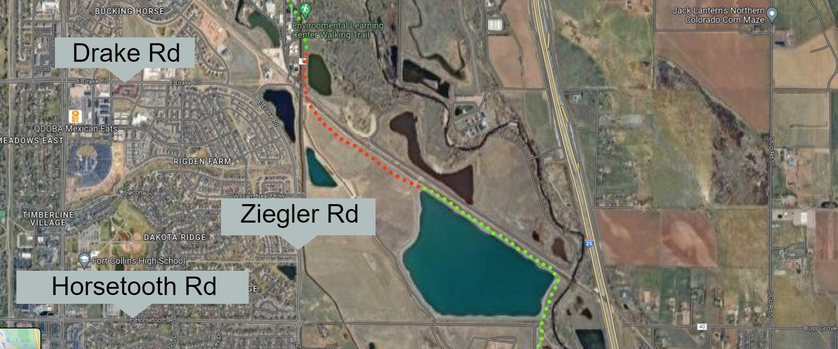
CSU Environmental Learning Center to Rigden Reservoir
The city has obtained easements to connect CSU’s Environmental Learning Center to the existing trail West of Arapahoe Bend Natural Area. Construction is planned to start in the fall and is expected to be completed by the end of the year.
The red dots indicate what needs to be completed. The green dots represent completed trail.
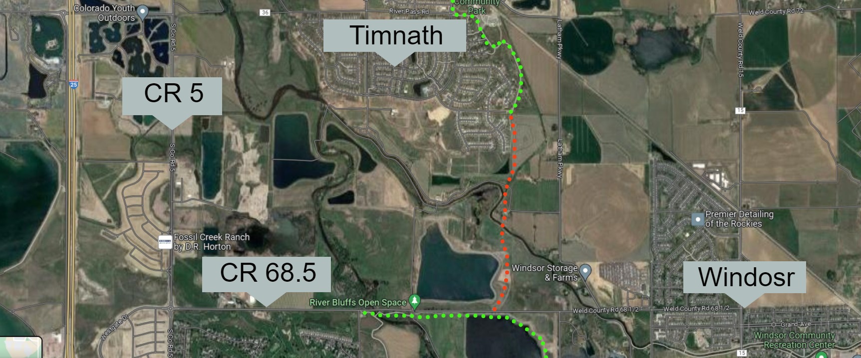
Windsor's Kyger Open Space North to Timnath.
Larimer County is in charge of this section connecting Windsor to Timnath.
SCOPE OF WORK
A ten-foot-wide concrete trail with soft shoulders will be constructed from the trail on the south side of LCCR 32E (WCR 68 1/2) (east of the River Bluffs trailhead) north to the Timnath South subdivision – approximately one mile. This segment is part of several segments included in GOCO (Great Outdoors Colorado) and CDOT grants. The other segments that are part of the grants are in the City of Fort Collins and the Towns of Timnath and Windsor. With CDOT’s replacement of the Interstate 25 Poudre River Bridge these combined projects will complete the trail between Fort Collins and Greeley.
PROJECT STATUS
The final design is complete and easement acquisition is ongoing. Construction is anticipated to begin in the summer of 2024 and completed by the winter of 2024/2025.
The red dots indicate what needs to be completed. The green dots represent completed trail. This section is about 1 mile long.
Official Project Map
If you enjoy this content and appreciate the hustle that goes into YGR please consider supporting the site.