On June 1st, Lory State Park, Fort Collins Natural Areas, Larimer County Natural Resources and Loveland Parks and Rec transitioned to COTREX- Colorado Trails Explorer to report local trail conditions. The phone and web app is a project led by Colorado Parks and Wildlife (CPW) and Department of Natural Resources and is made possible through partnerships with organizations at every level statewide. COTREX represents trails managed by over 230 land managers. YGR’s Northern Colorado Trail Conditions page has been updated to reflect the change. Although I have not confirmed it, it appears that trail users can also report trail conditions.
The trail mapping software isn’t just for announcing trail conditions, however. Read on to see what else it can do.
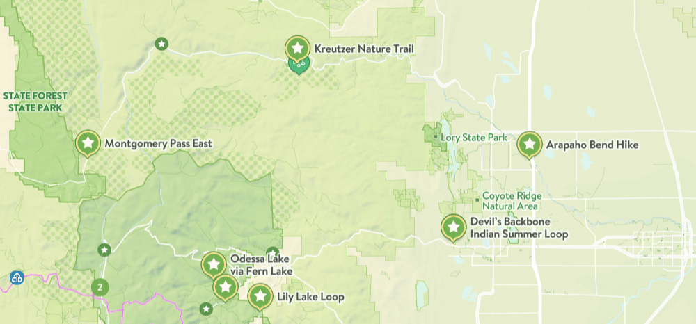
View trails by allowed uses on the map, browse featured routes, download offline maps, record trips and notes in the field, complete challenges to earn badges, and share your experiences with the community. COTREX is your gateway into Colorado’s magnificent outdoors.
■ DISCOVER TRAILS & FEATURED ROUTES
– Browse or search to find trails and Feature Routes that match your activities or interests.
– Change activity type to dynamically filter trails on the map.
■ OFFLINE MAPS
– No cell coverage? No problem! Download maps ahead of time for a continuous experience that doesn’t depend on your network.
– COTREX offline maps are lightweight in size and easy to download.
■ RECORD TRIPS & FIELD NOTES
– Capture the details of your outdoor experiences by recording Trips.
– Go beyond simple photos by taking and classifying rich Field Notes along the way. Choose from 45,000+ classifications that include trail conditions, species, rocks and minerals, historic places, points of interest, and much more.
– Seamlessly sync activity recorded on your devices with the web.
■ COMPLETE CHALLENGES TO EARN BADGES
– By recording and classifying Field Notes, you can complete Challenges and earn Badges for your profile.
■ SHARE WITH THE COMMUNITY
– Inform and inspire the entire COTREX community by sharing your Trips and Field Notes publicly or submitting Trip Reports.
– View activity feeds for all users or just the ones you follow.
– By sharing your experiences, you also help to inform trail managers about current conditions on the ground.
■ MORE INFORMATION
You can view the web app here: https://trails.colorado.gov/
Download the phone apps here:
Apple- https://apps.apple.com/us/app/colorado-trail-explorer/id1435737776
Andriod- https://play.google.com/store/apps/details?id=com.cotrexapp